
1891 Map of St. George
USGS Topo · Published 1891About this map
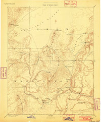
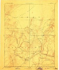
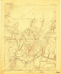
St George serves as the focal point of this 1891 survey, situated at the confluence of desert and mountain landscapes in southwestern Utah. The map reveals a network of early pioneer settlements connected by rugged terrain, including Silver Reef, known for its silver mining in sandstone, and the historic iron-works at Iron City. To the north, the Mountain Meadows area sits between the Iron Mountains and the Escalante Desert, while the massive bulk of Pine Valley Mountain dominates the center of the sheet.
Find a feature on this map
49 named features on this map. Tap any name to fly to it.
Don’t see what you’re looking for? This feature index may not catch every label — zoom into the map to look around manually.
Map Details
Editions of this 1891 St. George Map
4 editions found
Other maps of this area

1885 · St. George
USGS Topo · 1:250,000

1885 · Beaver
USGS Topo · 1:250,000

1885 · Pioche
USGS Topo · 1:250,000

1886 · Kanab
USGS Topo · 1:250,000

1886 · Saint Thomas
USGS Topo · 1:250,000

1886 · Mt. Trumbull
USGS Topo · 1:250,000

1886 · Pioche
USGS Topo · 1:250,000

1886 · Kaibab
USGS Topo · 1:250,000

1892 · Mt. Trumbull
USGS Topo · 1:250,000

1893 · Saint Thomas
USGS Topo · 1:250,000