
1965 Map of St. Helen
USGS Topo · Published 1966About this map
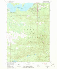
Lake St Helen dominates the northern landscape of this Roscommon County region, featuring distinctive points like Birch Point and Norway Point along its irregular shoreline. The settlement of St Helen serves as a central hub, flanked by the New York Central Railroad and the St Helen Landing Field. The map reveals a transition from these organized settlements and lakefront properties at Artesia Beach into the dense woodlands of the Houghton Lake State Forest.
Find a feature on this map
33 named features on this map. Tap any name to fly to it.
Don’t see what you’re looking for? This feature index may not catch every label — zoom into the map to look around manually.
Map Details
Editions of this 1965 St. Helen Map
2 editions found
Other maps of this area

1954 · Traverse City
USGS Topo · 1:250,000

1958 · Traverse City
USGS Topo · 1:250,000

1963 · Roscommon South
USGS Topo · 1:24,000

1963 · Backus Lake
USGS Topo · 1:24,000

1965 · St. Helen NW
USGS Topo · 1:24,000

1965 · St. Helen NE
USGS Topo · 1:24,000

1965 · Ogemaw Springs
USGS Topo · 1:24,000

1969 · Meredith
USGS Topo · 1:24,000

1969 · Edwards
USGS Topo · 1:24,000

1969 · Butman
USGS Topo · 1:24,000