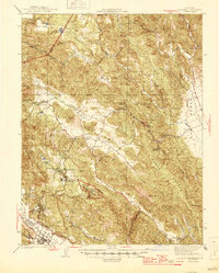
1945 Map of St. Helena
USGS Topo · Published 1945About this map
The St Helena township and the agricultural corridors of the northern Napa Valley are documented in this mid-century survey. The western edge highlights the Southern Pacific RR and the Silverado Trail as they parallel the valley floor, while the rugged interior showcases the development around Howell Mountain, including the Pacific Union College campus at Angwin and the nearby Sanitarium. To the east, the landscape transitions into the isolated basins of Pope Valley and Chiles Valley, where remote community centers like the Central Sch and Hardin Sch served a sparse population of ranchers and miners.
Find a feature on this map
61 named features on this map. Tap any name to fly to it.
Don’t see what you’re looking for? This feature index may not catch every label — zoom into the map to look around manually.
Map Details
Editions of this 1945 St. Helena Map
2 editions found

Other maps of this area

1902 · Napa
USGS Topo · 1:125,000

1916 · Santa Rosa
USGS Topo · 1:62,500

1921 · Mt. Vaca
USGS Topo · 1:62,500

1924 · Capay
USGS Topo · 1:62,500

1927 · Calistoga
USGS Topo · 1:62,500

1942 · Sonoma
USGS Topo · 1:62,500

1942 · Mt. Vaca
USGS Topo · 1:62,500

1942 · St. Helena
USGS Topo · 1:62,500

1943 · Morgan Valley
USGS Topo · 1:62,500

1943 · Capay
USGS Topo · 1:62,500