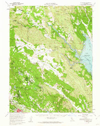
1960 Map of St. Helena
USGS Topo · Published 1962About this map
The winemaking heritage of Napa County is deeply rooted in this 1960s topographic survey, which highlights legendary estates like Beringer Bros Winery, Krug Winery, and Sutter Home Winery along the Southern Pacific rail line. The town of St Helena serves as the valley's anchor, while the surrounding highlands reveal a complex geography of institutional and industrial activity. To the east, the sprawling waters of Lake Berryessa and Lake Hennessey dominate the drainage basins of Putah Creek and Chiles Creek.
Find a feature on this map
102 named features on this map. Tap any name to fly to it.
Don’t see what you’re looking for? This feature index may not catch every label — zoom into the map to look around manually.
Map Details
Editions of this 1960 St. Helena Map
2 editions found
Other maps of this area

1902 · Napa
USGS Topo · 1:125,000

1916 · Santa Rosa
USGS Topo · 1:62,500

1921 · Mt. Vaca
USGS Topo · 1:62,500

1924 · Capay
USGS Topo · 1:62,500

1927 · Calistoga
USGS Topo · 1:62,500

1942 · Sonoma
USGS Topo · 1:62,500

1942 · Mt. Vaca
USGS Topo · 1:62,500

1942 · St. Helena
USGS Topo · 1:62,500

1943 · Morgan Valley
USGS Topo · 1:62,500

1943 · Capay
USGS Topo · 1:62,500