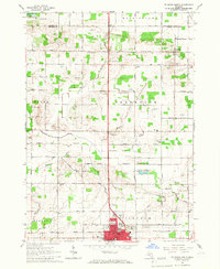
1965 Map of St. Johns North
USGS Topo · Published 1967About this map
St Johns stands as the primary hub of this 1965 survey, showcasing a dense grid of residential and municipal structures including the Courthouse, Waterworks, and East Ward Sch. Beyond the city limits, the landscape transitions into a well-defined agricultural grid across Greenbush and Bingham townships. A complex network of drainage features like Bennett Drain and Silvernail Drain signifies the intensive land management required for mid-century Michigan farming. To the north, the Maple River wanders through the Maple River State Game Area, providing a distinct natural break from the surrounding fields. Local history is preserved in rural landmarks such as Salem Ch, Greenbush Ch, and numerous family-named schoolhouses like Parker Sch and Sherwood Sch, alongside quiet resting places such as Union Home Cem and Prairie Cem.
Find a feature on this map
67 named features on this map. Tap any name to fly to it.
Don’t see what you’re looking for? This feature index may not catch every label — zoom into the map to look around manually.
Map Details
Editions of this 1965 St. Johns North Map
2 editions found
Other maps of this area

1918 · Elsie
USGS Topo · 1:62,500

1918 · Perrinton
USGS Topo · 1:62,500

1927 · De Witt
USGS Topo · 1:62,500

1928 · Laingsburg
USGS Topo · 1:62,500

1943 · Perrinton
USGS Topo · 1:62,500

1943 · Elsie
USGS Topo · 1:62,500

1944 · Laingsburg
USGS Topo · 1:62,500

1954 · Midland
USGS Topo · 1:250,000

1958 · Midland
USGS Topo · 1:250,000

1958 · Grand Rapids
USGS Topo · 1:250,000