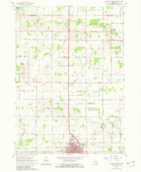
1965 Map of St. Johns North
USGS Topo · Published 1982About this map
The county seat of St Johns anchors this mid-century survey, revealing a well-organized agricultural landscape in central Michigan. The map captures the city's infrastructure at a point of modernization, featuring the waterworks, a radio tower, and the Mount Rest Cemetery. Just north of the urban center, leisure and utility intersect at a drive-in theater and the regional sewage disposal site.
Find a feature on this map
77 named features on this map. Tap any name to fly to it.
Don’t see what you’re looking for? This feature index may not catch every label — zoom into the map to look around manually.
Map Details
Editions of this 1965 St. Johns North Map
2 editions found
Other maps of this area

1918 · Elsie
USGS Topo · 1:62,500

1918 · Perrinton
USGS Topo · 1:62,500

1927 · De Witt
USGS Topo · 1:62,500

1928 · Laingsburg
USGS Topo · 1:62,500

1943 · Perrinton
USGS Topo · 1:62,500

1943 · Elsie
USGS Topo · 1:62,500

1944 · Laingsburg
USGS Topo · 1:62,500

1954 · Midland
USGS Topo · 1:250,000

1958 · Midland
USGS Topo · 1:250,000

1958 · Grand Rapids
USGS Topo · 1:250,000