Loading...
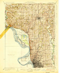
Loading map...1926 Map of St. Joseph
USGS Topo · Published 1926About this map
St Joseph dominates the southern edge of this mid-1920s survey, showing a dense urban grid supported by the Waterworks and the sprawling grounds of the State Hospital. The landscape north through Jefferson and Lincoln townships is defined by a dense network of country schools and churches, reflecting a robust rural population before the mid-century consolidation of districts. Notable social landmarks like the County Farm near Juntown Church indicate the era's local infrastructure for public welfare.
Find a feature on this map
65 named features on this map. Tap any name to fly to it.
Don’t see what you’re looking for? This feature index may not catch every label — zoom into the map to look around manually.
Map Details
Date Portrayed1926
Date Published1926
PublisherU.S. Geological Survey
Map TypeTopographic
Scale1:62,500
Physical Dimensions16.3 x 19.9 inches
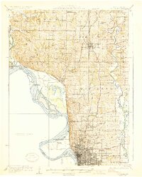
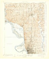
Editions of this 1926 St. Joseph Map
3 editions found
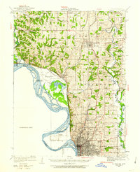
Historical Maps of Saint Joseph Through Time
Featured Locations
Source Details
SourceU.S. Geological Survey
CopyrightPublic Domain