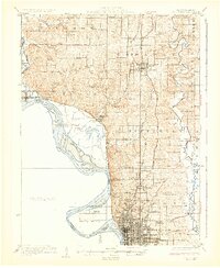
1926 Map of Saint Joseph
USGS Topo · Published 1926About this map
St. Joseph and Savannah anchor this mid-1920s topographical study of the Missouri River valley, where the border between Missouri and Kansas follows the shifting waters. The landscape is defined by the heavy infrastructure of the Chicago Great Western and Chicago Burlington and Quincy railroads, which supported a rural economy dotted with one-room schoolhouses like Hummon School, Gee School, and Liggett School. The topography reveals the complex drainage of the One Hundred and Two River and Nodaway River as they converge toward the floodplain.
Find a feature on this map
68 named features on this map. Tap any name to fly to it.
Don’t see what you’re looking for? This feature index may not catch every label — zoom into the map to look around manually.
Map Details
Editions of this 1926 Saint Joseph Map
3 editions found
Other maps of this area

1885 · Atchison
USGS Topo · 1:125,000

1888 · Atchison
USGS Topo · 1:125,000

1893 · Atchison
USGS Topo · 1:125,000

1923 · Clarksdale
USGS Topo · 1:62,500

1924 · St. Joseph
USGS Topo · 1:62,500

1925 · Gower
USGS Topo · 1:62,500

1925 · Clarksdale
USGS Topo · 1:62,500

1925 · Stanberry
USGS Topo · 1:62,500

1926 · Atchison
USGS Topo · 1:62,500

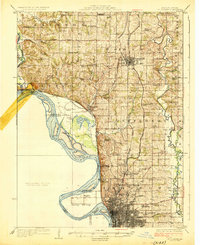
1926 · Saint Joseph
USGS Topo · 1:62,500