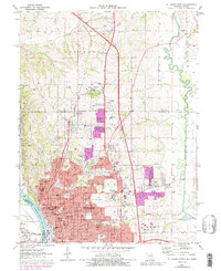
1971 Map of St. Joseph North
USGS Topo · Published 1989About this map
St Joseph serves as the focal point of this Buchanan County survey, showing the city's northward expansion into the surrounding Washington and Jefferson townships. The landscape is characterized by a dense network of civic and religious institutions, including the expansive grounds of State Hospital No 2 and numerous parochial schools such as Christian Brothers High Sch and St Francis Xavier Sch. Transport routes like the Union Pacific RR and the Burlington Northern lines trace the industrial corridors near the Missouri River.
Find a feature on this map
75 named features on this map. Tap any name to fly to it.
Don’t see what you’re looking for? This feature index may not catch every label — zoom into the map to look around manually.
Map Details
Editions of this 1971 St. Joseph North Map
4 editions found
Other maps of this area

1923 · Clarksdale
USGS Topo · 1:62,500

1924 · St. Joseph
USGS Topo · 1:62,500

1925 · Gower
USGS Topo · 1:62,500

1925 · Clarksdale
USGS Topo · 1:62,500

1926 · Saint Joseph
USGS Topo · 1:62,500

1927 · Dearborn
USGS Topo · 1:62,500

1950 · Kansas City
USGS Topo · 1:250,000

1954 · Kansas City
USGS Topo · 1:250,000

1956 · Kansas City
USGS Topo · 1:250,000

1960 · Kansas City
USGS Topo · 1:250,000