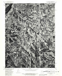
1980 Map of St. Joseph South
USGS Topo · Published 1981About this map
St Joseph and its southern agricultural hinterlands are captured in this orthophotograph, providing a detailed look at the landscape of Buchanan County during the early 1980s. The Missouri Department of Natural Resources and the Soil Conservation Service collaborated on this data, which blends 1980 aerial photography with 1971 land lines to show the expansion of the city alongside the traditional rural landscape. The winding course of Contrary Creek carves through the undulating terrain south of the urban center, while the massive Missouri River defines the western edge of the region.
Find a feature on this map
6 named features on this map. Tap any name to fly to it.
Don’t see what you’re looking for? This feature index may not catch every label — zoom into the map to look around manually.
Map Details
Editions of this 1980 St. Joseph South Map
This is the sole edition of this map. No revisions or reprints were ever made.
Other maps of this area

1923 · Clarksdale
USGS Topo · 1:62,500

1924 · St. Joseph
USGS Topo · 1:62,500

1925 · Gower
USGS Topo · 1:62,500

1925 · Clarksdale
USGS Topo · 1:62,500

1926 · Saint Joseph
USGS Topo · 1:62,500

1927 · Dearborn
USGS Topo · 1:62,500

1950 · Kansas City
USGS Topo · 1:250,000

1951 · Edgerton
USGS Topo · 1:24,000
1951 · De Kalb
USGS Topo · 1:24,000
1951 · Dearborn
USGS Topo · 1:24,000