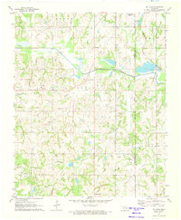
1972 Map of St. Louis
USGS Topo · Published 1974About this map
The St Louis Oil Field and Konawa Oil Field dominate this 1970s landscape on the border of Pottawatomie and Seminole counties. Hundreds of Oil Wells and a dedicated Refinery indicate an area defined by petroleum extraction, centered on the settlement of St Louis. Just to the south, the community of Sacred Heart sits near an Aqueduct, while the northeastern corner shows the edge of Maud and the Katy Reservoir.
Find a feature on this map
27 named features on this map. Tap any name to fly to it.
Don’t see what you’re looking for? This feature index may not catch every label — zoom into the map to look around manually.
Map Details
Editions of this 1972 St. Louis Map
2 editions found
Other maps of this area

1896 · Seminole and Prague
USGS Topo · 1:125,000

1901 · Stonewall
USGS Topo · 1:125,000

1907 · Maud
USGS Topo · 1:62,500

1908 · Maud
USGS Topo · 1:62,500

1954 · Oklahoma City
USGS Topo · 1:250,000

1957 · Ardmore
USGS Topo · 1:250,000

1957 · Oklahoma City
USGS Topo · 1:250,000
1958 · Pearson
USGS Topo · 1:24,000

1958 · Vamoosa
USGS Topo · 1:24,000

1958 · Konawa
USGS Topo · 1:24,000