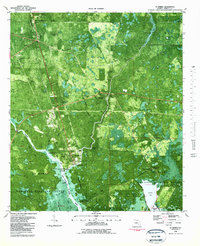
1982 Map of St Marks
USGS Topo · Published 1983About this map
St Marks and the adjacent settlement of Newport occupy a landscape where the river system meets the Gulf of Mexico. This 1982 orthophotomap provides a clear view of the marshy coastal environment within the St Marks National Wildlife Refuge, featuring several family and local cemeteries like Stewart Cem, Mays Cemetery, and Magnolia Cem. At the confluence of the Wakulla River and the St Marks River, the historic site of Fort San Marcos De Apalachee State Museum sits near the waterfront, while the Old Railroad Grade and The Florida Trail trace through the surrounding timber and wetlands. The map also records the presence of smaller rural congregations at New Mt Zion Church and Mt Pleasant Church, alongside hydrological features such as Newport Spring and Patterson Sink.
Find a feature on this map
63 named features on this map. Tap any name to fly to it.
Don’t see what you’re looking for? This feature index may not catch every label — zoom into the map to look around manually.
Map Details
Editions of this 1982 St Marks Map
3 editions found
Other maps of this area

1940 · Tallahassee
USGS Topo · 1:62,500

1940 · Arran
USGS Topo · 1:62,500

1942 · Tallahassee
USGS Topo · 1:62,500

1943 · Arran
USGS Topo · 1:62,500

1943 · Tallahassee
USGS Topo · 1:62,500

1954 · Sprague Island
USGS Topo · 1:24,000

1954 · Cody
USGS Topo · 1:24,000

1954 · Woodville
USGS Topo · 1:24,000

1954 · St. Marks NE
USGS Topo · 1:24,000

1954 · St. Marks
USGS Topo · 1:24,000