
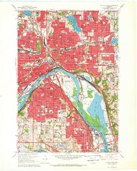
1967 Map of St. Paul East
USGS Topo · Published 1993About this map
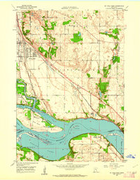
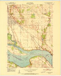
The Mississippi River carves through this detailed 1967 portrait of St. Paul and its southeastern suburbs, showing the city's complex urban fabric before late-century transformations. Dense residential grids in St Paul are punctuated by a significant concentration of parochial institutions like Sacred Heart Sch and St Agnes Sch, alongside expansive public works such as the St Paul Downtown Airport (Holman Field). The landscape is defined by its water and industry, where the river's bend cradles Raspberry Island and Harriet Island near the city center.
Find a feature on this map
78 named features on this map. Tap any name to fly to it.
Don’t see what you’re looking for? This feature index may not catch every label — zoom into the map to look around manually.
Map Details
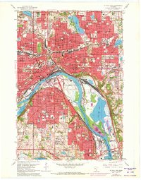
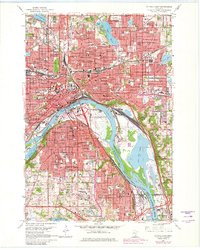
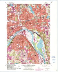
Editions of this 1967 St. Paul East Map
5 editions found
Other maps of this area

1896 · St. Paul
USGS Topo · 1:62,500

1902 · White Bear
USGS Topo · 1:62,500

1946 · Hudson
USGS Topo · 1:62,500

1948 · Stillwater
USGS Topo · 1:62,500

1949 · Hudson
USGS Topo · 1:62,500

1949 · Stillwater
USGS Topo · 1:62,500

1949 · Lake Elmo
USGS Topo · 1:24,000

1950 · Lake Elmo
USGS Topo · 1:24,000
1950 · St Paul Park
USGS Topo · 1:24,000
1951 · St Paul Park
USGS Topo · 1:24,000