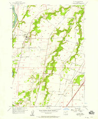
1956 Map of St. Paul
USGS Topo · Published 1958About this map
St Paul serves as the focal point of this mid-1950s survey of the Willamette Valley, where the Willamette River defines the western edge of Marion County. The landscape is characterized by a transition from traditional riverfront bars like Ray Bar and Mission Bar to an increasingly modern transport network. The emerging Baldock Freeway cuts through the southeastern corner near West Woodburn, signaling the shift toward high-speed transit that would soon bypass many of the rural centers. Evidence of earlier community structures remains visible in the documentation of the Arbor Grove School (Aban'd) and Four Corners Sch (Aban'd), while the St Louis School and Champoeg Cem preserve the region's pioneer and educational heritage. This area is further defined by its agricultural layout, stitched together by thoroughfares such as Champoeg-Salem Road and St Paul-Fairfield Road.
Find a feature on this map
42 named features on this map. Tap any name to fly to it.
Don’t see what you’re looking for? This feature index may not catch every label — zoom into the map to look around manually.
Map Details
Editions of this 1956 St. Paul Map
4 editions found
Other maps of this area

1916 · Tualatin
USGS Topo · 1:62,500

1923 · Mount Angel
USGS Topo · 1:62,500

1924 · Mc Minnville
USGS Topo · 1:48,000

1926 · Mc Minnville
USGS Topo · 1:62,500

1939 · Tualatin
USGS Topo · 1:62,500

1940 · McMinnville
USGS Topo · 1:62,500

1940 · Tualatin
USGS Topo · 1:62,500

1940 · Mount Angel
USGS Topo · 1:62,500

1941 · Yamhill
USGS Topo · 1:62,500

1942 · Yamhill
USGS Topo · 1:62,500