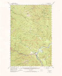
1956 Map of St Regis
USGS Topo · Published 1986About this map
The confluence of the Fork Clark Fork and the Clark Fork river defines the settlement of St Regis, where rail and river networks converge against the backdrop of the Coeur d'Alene Mountains. This mid-century survey captures the industrial and transportation corridor of Mineral County, Montana, featuring the competing lines of the Chicago Milwaukee St Paul and Pacific and the Pacific Northern railroads as they navigate the river valley. The landscape is dominated by the Lolo National Forest, marked by numerous fire-watch landmarks including the Flat Rock Lookout Station, Camel Hump Lookout Sta, and Arvilla Lookout Sta. Above the gulches and creeks, peaks like Cherry Peak and Sunset Peak overlook a terrain dotted with small-scale mines and the St Regis Beacon, reflecting the era's reliance on both resource extraction and aerial navigation aids.
Find a feature on this map
61 named features on this map. Tap any name to fly to it.
Don’t see what you’re looking for? This feature index may not catch every label — zoom into the map to look around manually.
Map Details
Editions of this 1956 St Regis Map
3 editions found
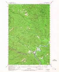
Other maps of this area

1918 · St Regis
USGS Topo · 1:125,000

1919 · St. Regis
USGS Topo · 1:125,000

1937 · Thompson Falls
USGS Topo · 1:125,000

1937 · Thompson Falls
USGS Topo · 1:62,500

1956 · St Regis
USGS Topo · 1:62,500

1956 · Wallace
USGS Topo · 1:250,000

1957 · Thompson Falls
USGS Topo · 1:62,500

1957 · Illinois Peak
USGS Topo · 1:62,500

1957 · Haugan
USGS Topo · 1:62,500

1957 · Simmons Peak
USGS Topo · 1:62,500