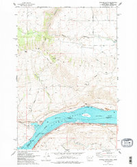
1974 Map of Stacker Butte
USGS Topo · Published 1977About this map
Lake Celilo dominates the southern landscape of this 1970s survey, marking the flooded reach of the Columbia River between the Washington and Oregon border. The map captures a complex transportation corridor where the Burlington Northern railroad hugs the northern shore and the Union Pacific runs along the southern bank. On the Washington side, the terrain rises sharply from the river through the Columbia Hills toward the high-altitude settlement of High Prairie.
Find a feature on this map
43 named features on this map. Tap any name to fly to it.
Don’t see what you’re looking for? This feature index may not catch every label — zoom into the map to look around manually.
Map Details
Editions of this 1974 Stacker Butte Map
2 editions found
Other maps of this area

1934 · The Dalles
USGS Topo · 1:125,000

1953 · The Dalles
USGS Topo · 1:250,000

1956 · The Dalles
USGS Topo · 1:250,000

1957 · The Dalles
USGS Topo · 1:250,000

1957 · Klickitat
USGS Topo · 1:62,500

1957 · Goldendale
USGS Topo · 1:62,500

1957 · The Dalles
USGS Topo · 1:62,500

1957 · Wishram
USGS Topo · 1:62,500

1974 · Stacker Butte
USGS Topo · 1:24,000

1974 · The Dalles North
USGS Topo · 1:24,000