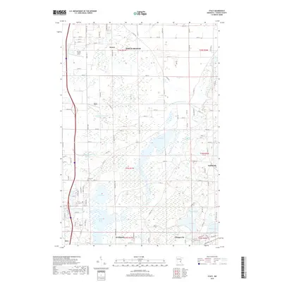
2019 Map of Stacy
USGS Topo · Published 2019About this map
North Branch and the southern edge of Chisago County define this landscape of interconnected wetlands and water management. The drainage patterns are dominated by extensive man-made channels like County Ditch Number Five and County Ditch Number Ten, which support the agricultural and residential development around the Sunrise River. This hydrologic system feeds into significant reservoirs and natural basins, including North Pool and Sunrise River Pool 1.
Find a feature on this map
102 named features on this map. Tap any name to fly to it.
Don’t see what you’re looking for? This feature index may not catch every label — zoom into the map to look around manually.
Map Details
Editions of this 2019 Stacy Map
This is the sole edition of this map. No revisions or reprints were ever made.
Other maps of this area

1950 · Rush City
USGS Topo · 1:48,000

1953 · Stillwater
USGS Topo · 1:250,000

1955 · Rush City
USGS Topo · 1:62,500

1955 · Forest Lake
USGS Topo · 1:62,500

1955 · Isanti
USGS Topo · 1:62,500

1955 · Stillwater
USGS Topo · 1:250,000

1958 · Stillwater
USGS Topo · 1:250,000

1961 · Cambridge
USGS Topo · 1:62,500

1965 · Stillwater
USGS Topo · 1:250,000
1974 · Stacy
USGS Topo · 1:24,000