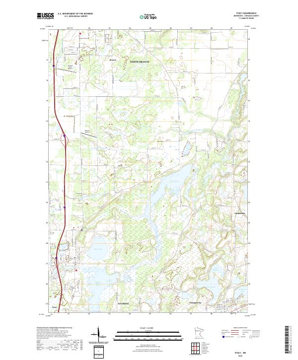
2022 Map of Stacy
USGS Topo · Published 2022About this map
Stacy and Wyoming anchor the southwestern corner of this survey, a landscape defined by the intricate hydrology of the Sunrise River and its complex network of pools and tributaries. The terrain is notably altered by an extensive drainage system, including the County Ditch Number Five and County Ditch Number Seven, which reflect long-standing efforts to manage the wetlands for agricultural and residential development. Local aviation history is represented by Al's Due North Airport and Bowers Airport, while the proximity of Chisago City and Lindstrom to the east highlights the area's transition into the lake-strewn region of Chisago County. Geographers and local historians can trace the grid of rural roads and the location of the Stacy Cem, providing a clear look at the spatial organization of these communities before further modern suburban expansion reached this part of the state.
Find a feature on this map
100 named features on this map. Tap any name to fly to it.
Don’t see what you’re looking for? This feature index may not catch every label — zoom into the map to look around manually.
Map Details
Editions of this 2022 Stacy Map
This is the sole edition of this map. No revisions or reprints were ever made.
Other maps of this area

1950 · Rush City
USGS Topo · 1:48,000

1953 · Stillwater
USGS Topo · 1:250,000

1955 · Rush City
USGS Topo · 1:62,500

1955 · Forest Lake
USGS Topo · 1:62,500

1955 · Isanti
USGS Topo · 1:62,500

1955 · Stillwater
USGS Topo · 1:250,000

1958 · Stillwater
USGS Topo · 1:250,000

1961 · Cambridge
USGS Topo · 1:62,500

1965 · Stillwater
USGS Topo · 1:250,000
1974 · Stacy
USGS Topo · 1:24,000