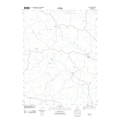
2012 Map of Stahl
USGS Topo · Published 2012About this map
Stahl and the surrounding Adair County countryside are defined by a network of rural routes and waterway branches feeding into the larger creek systems of northern Missouri. This early 21st-century survey reveals a landscape of dispersed agricultural settlements, including Sidney and Shibleys Point, connected by a web of county highways and roads. The terrain is deeply etched by water, with Shuteve Creek and Spring Creek carving paths through the rolling acreage. Genealogists will find an unusually dense concentration of family and community burial grounds, from the Husted Cemetery in the north to the Green Castle Cemetery in the south, preserving the names of the region's early inhabitants. The presence of Stroup Siding near the confluence of Turkey Creek and Spring Creek points to the area's logistical history, while the Union Ridge State Frst represents preserved natural space among the farmsteads.
Find a feature on this map
59 named features on this map. Tap any name to fly to it.
Don’t see what you’re looking for? This feature index may not catch every label — zoom into the map to look around manually.
Map Details
Editions of this 2012 Stahl Map
This is the sole edition of this map. No revisions or reprints were ever made.
Other maps of this area

1911 · Queen City
USGS Topo · 1:62,500

1912 · Green City
USGS Topo · 1:62,500

1913 · Queen City
USGS Topo · 1:62,500

1914 · Green City
USGS Topo · 1:62,500

1938 · Kirksville
USGS Topo · 1:62,500

1940 · Kirksville
USGS Topo · 1:62,500

1954 · Centerville
USGS Topo · 1:250,000

1957 · Centerville
USGS Topo · 1:250,000

1958 · Centerville
USGS Topo · 1:250,000

1963 · Pure Air
USGS Topo · 1:24,000