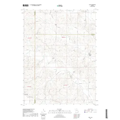
2017 Map of Stahl
USGS Topo · Published 2017About this map
Shibleys Point and the surrounding rural landscapes of Adair, Sullivan, and Putnam counties are defined by a network of winding creeks and family burial grounds in this contemporary survey. The terrain is deeply carved by watercourses including Shuteye Cr, Spring Creek, and S Blackbird Cr, which dictate the placement of local roads like Foothill Rd and Bethel Ridge Rd. The map is particularly valuable for genealogical research, documenting numerous small cemeteries such as Branstutter Cem, Morelock Cem, and Megrew Cem that are scattered throughout the hills. Small clusters of development remain at Stahl, Sidney, and the edge of Greencastle, while the artificial Spring Cr Ranch Lake provides a central water feature amidst the complex drainage patterns of Plum Br and Jobs Cr.
Find a feature on this map
74 named features on this map. Tap any name to fly to it.
Don’t see what you’re looking for? This feature index may not catch every label — zoom into the map to look around manually.
Map Details
Editions of this 2017 Stahl Map
This is the sole edition of this map. No revisions or reprints were ever made.
Other maps of this area

1911 · Queen City
USGS Topo · 1:62,500

1912 · Green City
USGS Topo · 1:62,500

1913 · Queen City
USGS Topo · 1:62,500

1914 · Green City
USGS Topo · 1:62,500

1938 · Kirksville
USGS Topo · 1:62,500

1940 · Kirksville
USGS Topo · 1:62,500

1954 · Centerville
USGS Topo · 1:250,000

1957 · Centerville
USGS Topo · 1:250,000

1958 · Centerville
USGS Topo · 1:250,000

1963 · Pure Air
USGS Topo · 1:24,000