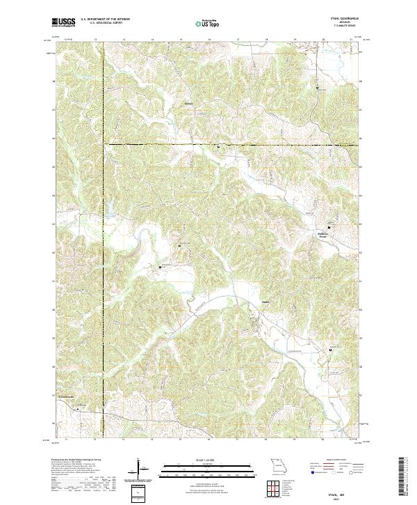
2021 Map of Stahl
USGS Topo · Published 2021About this map
Sidney and Stahl anchor this northern Missouri landscape where the borders of Adair, Sullivan, and Putnam Counties converge. The terrain is defined by a dense network of tributaries including Shuteye Cr, Spring Creek, and Jobs Cr, which carve through the land and dictate the winding paths of local routes like State Hwy AA and Bethel Ridge Rd. The map is particularly rich for genealogical research, documenting numerous family-named burial sites such as Husted Cem, Branstutter Cem, and Morelock Cem. Near the settlement of Greencastle, the Green Castle Cem sits atop a rise, while further east, the landmark of Shibleys Point and its associated Shibleys Point Cem provide a clear view of the rural communities that have long occupied these rolling hills.
Find a feature on this map
74 named features on this map. Tap any name to fly to it.
Don’t see what you’re looking for? This feature index may not catch every label — zoom into the map to look around manually.
Map Details
Editions of this 2021 Stahl Map
This is the sole edition of this map. No revisions or reprints were ever made.
Other maps of this area

1911 · Queen City
USGS Topo · 1:62,500

1912 · Green City
USGS Topo · 1:62,500

1913 · Queen City
USGS Topo · 1:62,500

1914 · Green City
USGS Topo · 1:62,500

1938 · Kirksville
USGS Topo · 1:62,500

1940 · Kirksville
USGS Topo · 1:62,500

1954 · Centerville
USGS Topo · 1:250,000

1957 · Centerville
USGS Topo · 1:250,000

1958 · Centerville
USGS Topo · 1:250,000

1963 · Pure Air
USGS Topo · 1:24,000