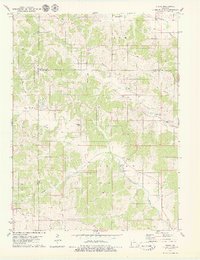
1979 Map of Stahl
USGS Topo · Published 1979About this map
The rolling landscape of the Putnam and Adair County line is defined by a dense network of family cemeteries and small rural settlements during the late 1970s. The small village of Stahl sits within Morrow township, while Green Castle occupies the southwestern corner of the sheet. For genealogists, the map is remarkably dense with burial sites, including the Branstutter, Husted, and Megrew cemeteries, which are scattered throughout the hills. A notable feature of the local industrial history is the Old Railroad Grade running through Penn township, tracing a former transportation artery that once connected these upland communities. The terrain is deeply dissected by numerous waterways such as Blackbird Creek, Shuteye Creek, and Spring Creek, which shaped the placement of early homesteads and the winding paths of the county roads.
Find a feature on this map
30 named features on this map. Tap any name to fly to it.
Don’t see what you’re looking for? This feature index may not catch every label — zoom into the map to look around manually.
Map Details
Editions of this 1979 Stahl Map
This is the sole edition of this map. No revisions or reprints were ever made.
Other maps of this area

1911 · Queen City
USGS Topo · 1:62,500

1912 · Green City
USGS Topo · 1:62,500

1913 · Queen City
USGS Topo · 1:62,500

1914 · Green City
USGS Topo · 1:62,500

1938 · Kirksville
USGS Topo · 1:62,500

1940 · Kirksville
USGS Topo · 1:62,500

1954 · Centerville
USGS Topo · 1:250,000

1957 · Centerville
USGS Topo · 1:250,000

1958 · Centerville
USGS Topo · 1:250,000

1963 · Pure Air
USGS Topo · 1:24,000