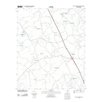
2011 Map of Staley Crossroads
USGS Topo · Published 2011About this map
Staley Crossroads serves as a central point in this part of Calhoun County, where rural life is defined by an intricate network of waterways and managed agricultural ponds. The landscape is dominated by the expansive Caw Caw Swamp and Coupen Swamp, which dictate the winding paths of local roads like Beaver Creek Rd. Numerous small-scale dams and reservoirs, such as Strawberry Pond and Ruckers Pond, illustrate the region's reliance on water management for land use. To the north of the crossroads, Alans Airport provides a rare point of modern infrastructure amidst the dense creek systems of Big Beaver Creek and Little Beaver Creek. The presence of family-named features and private landing strips suggests a community where large landholdings are common, and the natural drainage of Crim Creek and Falls Branch continues to shape the settlement pattern as it stood in the early 21st century.
Find a feature on this map
122 named features on this map. Tap any name to fly to it.
Don’t see what you’re looking for? This feature index may not catch every label — zoom into the map to look around manually.
Map Details
Editions of this 2011 Staley Crossroads Map
This is the sole edition of this map. No revisions or reprints were ever made.
Other maps of this area

1944 · Edmund
USGS Topo · 1:62,500

1946 · Woodford
USGS Topo · 1:62,500

1946 · St. Matthews
USGS Topo · 1:62,500

1948 · Hopkins
USGS Topo · 1:62,500

1953 · Saylors Lake
USGS Topo · 1:24,000

1953 · Gadsden
USGS Topo · 1:24,000

1954 · Augusta
USGS Topo · 1:250,000

1957 · Augusta
USGS Topo · 1:250,000

1958 · Augusta
USGS Topo · 1:250,000

1961 · Augusta
USGS Topo · 1:250,000