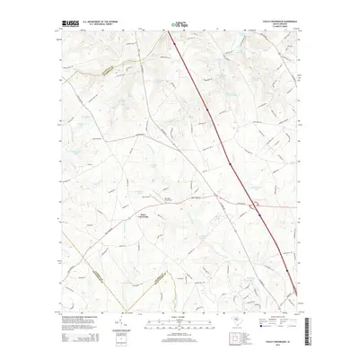
2014 Map of Staley Crossroads
USGS Topo · Published 2014About this map
Staley Crossroads serves as a central junction in this rural landscape, where the borders of Lexington, Calhoun, and Orangeburg counties meet. The area is defined by an extensive network of water and wetlands, notably the broad Caw Caw Swamp and Coupen Swamp, which dominate the drainage patterns of the coastal plain. Local industry and land use are reflected in the numerous private water bodies, such as Smiths Falls Pond, Rast Pond, and the Wannamakers Upper I-26 Pond, many of which appear to be family-owned impoundments. Aviation history in the region is marked by small-scale facilities including Alan's Airport and the descriptively named Do-Little Field Airport. The map also traces the winding courses of Limestone Cr and Murph Mill Cr, highlighting a terrain where traditional agriculture and swampy bottomlands coexist alongside modern transportation corridors.
Find a feature on this map
126 named features on this map. Tap any name to fly to it.
Don’t see what you’re looking for? This feature index may not catch every label — zoom into the map to look around manually.
Map Details
Editions of this 2014 Staley Crossroads Map
This is the sole edition of this map. No revisions or reprints were ever made.
Other maps of this area

1944 · Edmund
USGS Topo · 1:62,500

1946 · Woodford
USGS Topo · 1:62,500

1946 · St. Matthews
USGS Topo · 1:62,500

1948 · Hopkins
USGS Topo · 1:62,500

1953 · Saylors Lake
USGS Topo · 1:24,000

1953 · Gadsden
USGS Topo · 1:24,000

1954 · Augusta
USGS Topo · 1:250,000

1957 · Augusta
USGS Topo · 1:250,000

1958 · Augusta
USGS Topo · 1:250,000

1961 · Augusta
USGS Topo · 1:250,000