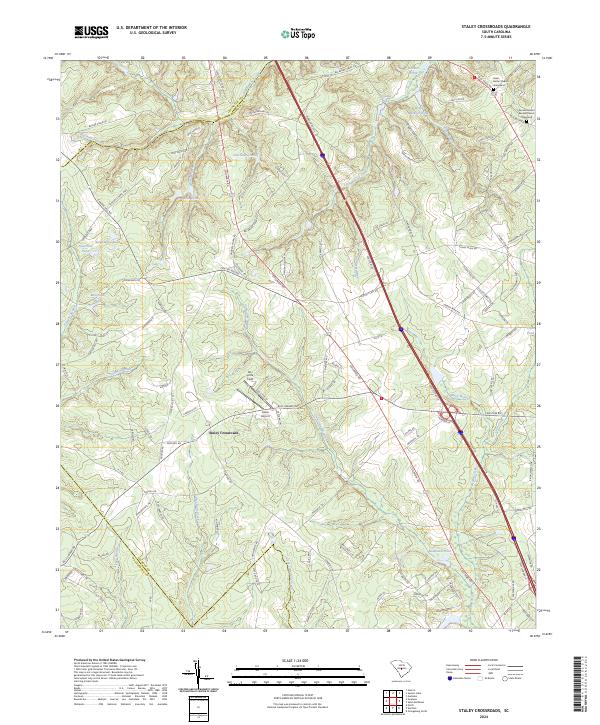
2024 Map of Staley Crossroads
USGS Topo · Published 2024About this map
Staley Crossroads sits at the heart of this landscape in Calhoun County, where a network of rural roads and water bodies define the local geography. The area is marked by a complex system of drainage and impoundments, including the distinctively named Willie Rucker Pond, Redmond Pond, and Culclosure Pond. Terrain features like Sand Mountain rise above the surrounding lowlands, while water travels through extensive natural corridors such as Cow Cow Swamp and Big Beaver Creek.
Find a feature on this map
127 named features on this map. Tap any name to fly to it.
Don’t see what you’re looking for? This feature index may not catch every label — zoom into the map to look around manually.
Map Details
Editions of this 2024 Staley Crossroads Map
This is the sole edition of this map. No revisions or reprints were ever made.
Other maps of this area

1944 · Edmund
USGS Topo · 1:62,500

1946 · Woodford
USGS Topo · 1:62,500

1946 · St. Matthews
USGS Topo · 1:62,500

1948 · Hopkins
USGS Topo · 1:62,500

1953 · Saylors Lake
USGS Topo · 1:24,000

1953 · Gadsden
USGS Topo · 1:24,000

1954 · Augusta
USGS Topo · 1:250,000

1957 · Augusta
USGS Topo · 1:250,000

1958 · Augusta
USGS Topo · 1:250,000

1961 · Augusta
USGS Topo · 1:250,000