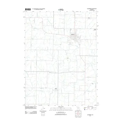
2011 Map of Stanberry
USGS Topo · Published 2011About this map
Stanberry serves as the primary hub of this North Central Missouri landscape, where a grid of rural routes and farmsteads connects the community to neighboring Mount Pleasant and Island City. The geography is defined by a dense network of waterways, including the winding Wildcat Creek, Island Creek, and the Walnut Fork of the Grand River, which dictate the placement of local thoroughfares like Gentry Nodaway Rd and Popcorn Rd. For those researching local lineages, the map identifies several key burial grounds established near these watercourses, such as Meekers Cemetery near Turkey Creek, as well as Cooper Cemetery and Granor Cemetery. The settlement pattern reflects a deeply rooted agricultural economy, with the township structure clearly visible through its section lines and the naming of family-related landmarks like Frank Jameson Rd.
Find a feature on this map
34 named features on this map. Tap any name to fly to it.
Don’t see what you’re looking for? This feature index may not catch every label — zoom into the map to look around manually.
Map Details
Editions of this 2011 Stanberry Map
This is the sole edition of this map. No revisions or reprints were ever made.
Other maps of this area

1925 · Stanberry
USGS Topo · 1:62,500

1925 · Darlington
USGS Topo · 1:62,500

1939 · Stanberry
USGS Topo · 1:62,500

1940 · Parnell
USGS Topo · 1:62,500

1942 · Grant City
USGS Topo · 1:62,500

1943 · Parnell
USGS Topo · 1:62,500

1943 · Grant City
USGS Topo · 1:62,500

1943 · Stanberry
USGS Topo · 1:62,500

1950 · Darlington
USGS Topo · 1:62,500

1955 · Nebraska City
USGS Topo · 1:250,000