1959 Map of Standard Wash
USGS Topo · Published 1964About this map
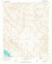
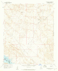
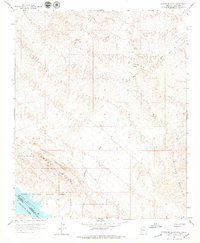
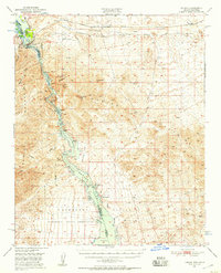
Mining operations and water sources define this arid landscape on the border of Arizona and California at the close of the 1950s. The topography is dominated by the Aubrey Hills and the Bill Williams Mountains, with the Standard Wash carving a path through the center toward the Colorado River. Prospectors and historians can trace several specific mineral claims in the northeast, including the El Campo Mine, Manitowoc Mine, and a primary shaft marked as Usmm 2815.
Find a feature on this map
18 named features on this map. Tap any name to fly to it.
Don’t see what you’re looking for? This feature index may not catch every label — zoom into the map to look around manually.
Map Details
Editions of this 1959 Standard Wash Map
3 editions found
Other maps of this area

1903 · Needles
USGS Topo · 1:125,000

1904 · Needles Special
USGS Topo · 1:125,000

1911 · Parker
USGS Topo · 1:125,000

1927 · Buck Mountains
USGS Topo · 1:62,500

1929 · Buck Mountains
USGS Topo · 1:62,500

1943 · Giers Basin
USGS Topo · 1:62,500

1943 · Topock
USGS Topo · 1:62,500

1943 · Whipple Mts.
USGS Topo · 1:62,500
1950 · Parker Dam Area
USGS Topo · 1:62,500
1950 · Topock
USGS Topo · 1:62,500