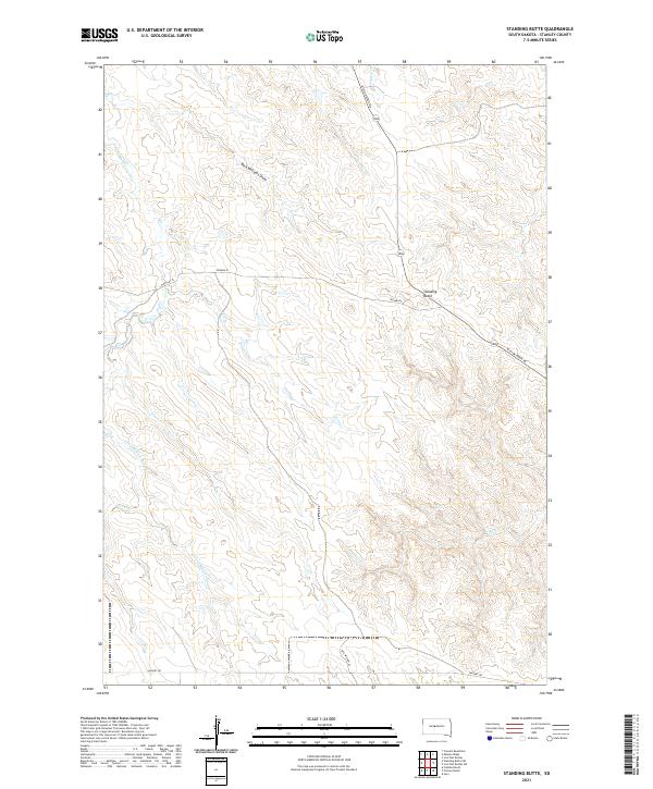
2021 Map of Standing Butte
USGS Topo · Published 2021About this map
Standing Butte serves as the central geographic landmark in this prairie landscape of Stanley County, where high plateaus are carved by a network of seasonal drainages. The area’s hydrology is defined by the branching tributaries of E Fork Minneconjou Cr and Chantier Cr, which cut deep draws through the undulating terrain. This 2021 survey reveals a remote ranching or agricultural environment structured by long-distance thoroughfares such as Mission Ridge Rd and Sansarc Rd. The placement of Tatanka Pl and Woolley Pl reflects a sparse but organized settlement pattern typical of the western South Dakota plains. These named roads and water features, including Buck Williams Draw, provide essential navigation points across the vast stretches of open land between the Missouri and Cheyenne river basins.
Find a feature on this map
16 named features on this map. Tap any name to fly to it.
Don’t see what you’re looking for? This feature index may not catch every label — zoom into the map to look around manually.
Map Details
Editions of this 2021 Standing Butte Map
This is the sole edition of this map. No revisions or reprints were ever made.
Other maps of this area

1937 · Oahe
USGS Topo · 1:62,500

1954 · Pierre
USGS Topo · 1:250,000

1956 · Crockett Mountains
USGS Topo · 1:24,000

1958 · Pierre
USGS Topo · 1:250,000

1973 · Iron Post Buttes SW
USGS Topo · 1:24,000

1973 · Iron Post Buttes
USGS Topo · 1:24,000

1980 · Princes Ranch
USGS Topo · 1:25,000
1982 · Lacy
USGS Topo · 1:24,000

1982 · Mission Ridge
USGS Topo · 1:24,000

1983 · Standing Butte
USGS Topo · 1:24,000