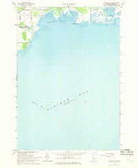
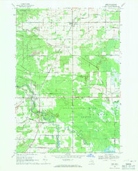
1967 Map of Standish NE
USGS Topo · Published 1969About this map
Rifle River flows into the northern reaches of Saginaw Bay, carving a path through the townships of Standish and Au Gres in this late 1960s coastal study. The map detail highlights a shifting aquatic landscape, including the Rifle River (Old Channel) and the broad expanse of Wigwam Bay. On shore, a network of local thoroughfares like Arenac State Road, Langdon Road, and Palmer Road define the rural agricultural and residential layout of the era.
Find a feature on this map
15 named features on this map. Tap any name to fly to it.
Don’t see what you’re looking for? This feature index may not catch every label — zoom into the map to look around manually.
Map Details
Editions of this 1967 Standish NE Map
This is the sole edition of this map. No revisions or reprints were ever made.
Other maps of this area

1954 · Flint
USGS Topo · 1:250,000

1954 · Tawas City
USGS Topo · 1:250,000

1958 · Flint
USGS Topo · 1:250,000

1958 · Tawas City
USGS Topo · 1:250,000

1966 · Au Gres
USGS Topo · 1:24,000
1967 · Pinconning
USGS Topo · 1:24,000
1967 · Standish
USGS Topo · 1:24,000
1968 · Omer SW
USGS Topo · 1:24,000
1968 · Omer
USGS Topo · 1:24,000

1984 · Tawas City
USGS Topo · 1:100,000