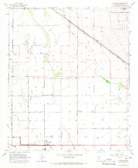
1965 Map of Stanfield
USGS Topo · Published 1967About this map
Stanfield serves as the focal point for this mid-1960s desert agricultural landscape, situated along the Southern Pacific railroad line. The settlement's infrastructure includes Stanfield Sch and Potter Sch, alongside Potter Airfield, indicating a community tied to aviation and aerial crop management. The terrain is defined by the ephemeral courses of Santa Cruz Wash and Santa Rosa Wash, which traverse a landscape heavily organized into a grid of section lines and irrigation wells.
Find a feature on this map
27 named features on this map. Tap any name to fly to it.
Don’t see what you’re looking for? This feature index may not catch every label — zoom into the map to look around manually.
Map Details
Editions of this 1965 Stanfield Map
2 editions found
Other maps of this area

1913 · Maricopa
USGS Topo · 1:62,500

1914 · Gila Butte
USGS Topo · 1:62,500

1915 · Maricopa
USGS Topo · 1:62,500

1917 · Gila Butte
USGS Topo · 1:62,500

1922 · Casa Grande
USGS Topo · 1:62,500

1924 · Casa Grande
USGS Topo · 1:62,500

1946 · Antelope Peak
USGS Topo · 1:62,500

1948 · Antelope Peak
USGS Topo · 1:62,500

1952 · Gila Butte SE
USGS Topo · 1:24,000

1952 · Maricopa
USGS Topo · 1:24,000