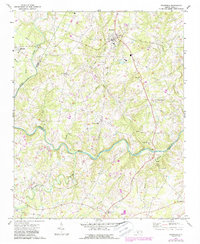
1971 Map of Stanfield
USGS Topo · Published 1987About this map
Stanfield and Midland anchor this topography at the boundary of Cabarrus and Stanly counties, an area defined by the winding course of the Rocky River. The landscape is densely populated with community landmarks, particularly a significant concentration of rural churches such as Loves Chapel Ch, Indian Hill Ch, and Friendship Ch. The mapping reveals a detailed network of watercourses feeding into the river, including Pumpkin Creek and Crooked Creek.
Find a feature on this map
31 named features on this map. Tap any name to fly to it.
Don’t see what you’re looking for? This feature index may not catch every label — zoom into the map to look around manually.
Map Details
Editions of this 1971 Stanfield Map
2 editions found
Other maps of this area

1941 · Charlotte
USGS Topo · 1:125,000

1942 · Charlotte
USGS Topo · 1:125,000

1949 · Midland
USGS Topo · 1:24,000

1949 · Concord SE
USGS Topo · 1:24,000

1953 · Charlotte
USGS Topo · 1:250,000

1954 · Charlotte
USGS Topo · 1:250,000

1957 · Mount Pleasant
USGS Topo · 1:62,500

1960 · Charlotte
USGS Topo · 1:250,000

1962 · Charlotte
USGS Topo · 1:250,000
1969 · Concord SE
USGS Topo · 1:24,000