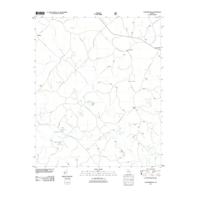
2011 Map of Stanfordville
USGS Topo · Published 2011About this map
Union Hill and Stanfordville anchor this rural Jones County landscape, characterized by a complex network of forest roads and creek-fed valleys in the early 21st century. The map reveals a land utilized for both conservation and recreation, evidenced by numerous hunting camps including Mathis Hunt Camp, Oak Grove Hunt Camp, and Culp Hunt Camp. The terrain is deeply carved by waterways such as Cedar Creek, Glady Creek, and Shoal Creek, while the presence of Mathis Lookout suggests the importance of forest fire monitoring in this heavily wooded region.
Find a feature on this map
44 named features on this map. Tap any name to fly to it.
Don’t see what you’re looking for? This feature index may not catch every label — zoom into the map to look around manually.
Map Details
Editions of this 2011 Stanfordville Map
This is the sole edition of this map. No revisions or reprints were ever made.
Other maps of this area

1953 · Athens
USGS Topo · 1:250,000

1958 · Athens
USGS Topo · 1:250,000

1959 · Athens
USGS Topo · 1:250,000

1963 · Athens
USGS Topo · 1:250,000

1964 · Gray
USGS Topo · 1:24,000
1964 · Dames Ferry
USGS Topo · 1:24,000

1964 · Stanfordville
USGS Topo · 1:24,000

1964 · Hillsboro
USGS Topo · 1:24,000

1972 · Monticello
USGS Topo · 1:24,000

1972 · Eatonton
USGS Topo · 1:24,000