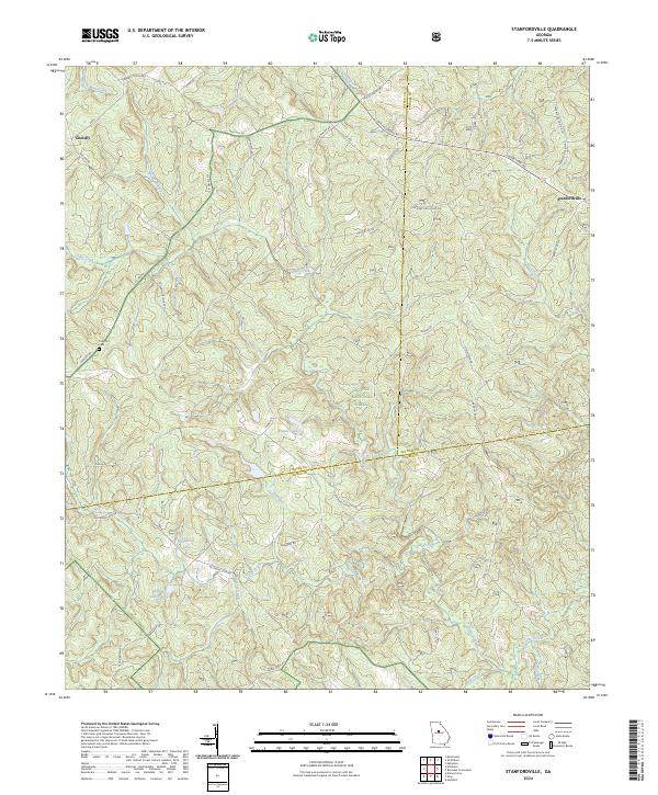
2024 Map of Stanfordville
USGS Topo · Published 2024About this map
The Oconee National Forest covers much of this landscape where the borders of Jasper, Putnam, and Jones counties meet. This rural area is defined by its network of watercourses, including the central Cedar Creek and Glady Creek, which drain the timbered ridges and hollows. Small settlements like Goolsby and Stanfordville anchor the local road system, connected by routes such as Old Hillsboro Rd and Gov't Rd. Family names are deeply etched into the geography, visible in landmarks like the Fullerton Cem and several private reservoirs including Dumas Lake and Walker Laney Lake. The terrain is crisscrossed by forest service and county roads, reflecting a contemporary balance between private landholdings and federal forest management. For the local historian, the map preserves the exact placement of cemetery sites and rural junctions that have served these Piedmont communities for generations.
Find a feature on this map
47 named features on this map. Tap any name to fly to it.
Don’t see what you’re looking for? This feature index may not catch every label — zoom into the map to look around manually.
Map Details
Editions of this 2024 Stanfordville Map
This is the sole edition of this map. No revisions or reprints were ever made.
Other maps of this area

1953 · Athens
USGS Topo · 1:250,000

1958 · Athens
USGS Topo · 1:250,000

1959 · Athens
USGS Topo · 1:250,000

1963 · Athens
USGS Topo · 1:250,000

1964 · Gray
USGS Topo · 1:24,000
1964 · Dames Ferry
USGS Topo · 1:24,000

1964 · Stanfordville
USGS Topo · 1:24,000

1964 · Hillsboro
USGS Topo · 1:24,000

1972 · Monticello
USGS Topo · 1:24,000

1972 · Eatonton
USGS Topo · 1:24,000