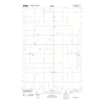
2010 Map of Stangelville
USGS Topo · Published 2010About this map
Saint Josephs Catholic Cemetery and Saint Lawrence Catholic Cemetery anchor a landscape defined by small Wisconsin hamlets and family-held agricultural lands. This late-twentieth-century study shows a distribution of settlements like Pilsen, Stangelville, and Ellisville connected by a grid of farm roads and county highways. The drainage patterns of the East Twin River and Scarboro Creek carve through the terrain, which rises to prominent points such as Montpelier Hills and Cherneyville Hill. For family historians, the abundance of specific religious burial grounds, including Saint Wenceslaus Cemetery and Saint John Nepomuceue Catholic Cemetery, provides precise geographic points for tracing local heritage in this rural Kewaunee County township.
Find a feature on this map
54 named features on this map. Tap any name to fly to it.
Don’t see what you’re looking for? This feature index may not catch every label — zoom into the map to look around manually.
Map Details
Editions of this 2010 Stangelville Map
This is the sole edition of this map. No revisions or reprints were ever made.
Other maps of this area

1952 · Casco
USGS Topo · 1:62,500

1954 · Kewaunee
USGS Topo · 1:62,500

1954 · Denmark
USGS Topo · 1:62,500

1954 · New Franken
USGS Topo · 1:62,500

1954 · Manitowoc
USGS Topo · 1:250,000

1958 · Manitowoc
USGS Topo · 1:250,000

1978 · Casco
USGS Topo · 1:24,000

1978 · Denmark
USGS Topo · 1:24,000

1978 · Poland
USGS Topo · 1:24,000

1978 · Stangelville
USGS Topo · 1:24,000