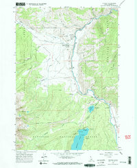
1963 Map of Stanley
USGS Topo · Published 1974About this map
The confluence of the Salmon River and Valley Creek anchors this mid-century survey of the Stanley Basin. The small settlement of Stanley and the cluster at Lower Stanley serve as the primary hubs for the region, supported by infrastructure like the Stanley Municipal Airport and the Valley Creek Ranger Station. The map illustrates a landscape shaped by both water and resource extraction, featuring a Mine to the north and the thermal waters of Hot Spring along the riverbank.
Find a feature on this map
41 named features on this map. Tap any name to fly to it.
Don’t see what you’re looking for? This feature index may not catch every label — zoom into the map to look around manually.
Map Details
Editions of this 1963 Stanley Map
3 editions found
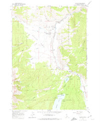
Other maps of this area

1891 · Bear Valley
USGS Topo · 1:125,000

1893 · Bear Valley
USGS Topo · 1:125,000

1919 · Custer
USGS Topo · 1:125,000

1922 · Custer
USGS Topo · 1:125,000

1957 · Challis
USGS Topo · 1:250,000

1960 · Challis
USGS Topo · 1:250,000

1963 · Challis
USGS Topo · 1:250,000

1963 · Mt Cramer
USGS Topo · 1:24,000

1963 · Stanley
USGS Topo · 1:24,000

1963 · Basin Butte
USGS Topo · 1:24,000