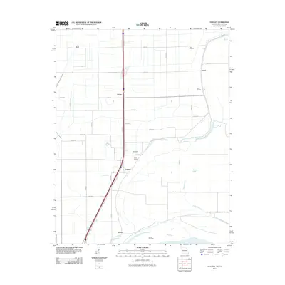
2012 Map of Stanley
USGS Topo · Published 2012About this map
Gayoso and its surrounding alluvial plains in Pemiscot County are defined by the powerful presence of the Mississippi River at the southern edge of the quadrangle. The landscape is a network of drainage features like Stancil Bayou, Dry Bayou, and the swampy basin of Robinson Lake, reflecting the hydrological complexity of the Missouri bootheel. Small, scattered settlements such as Stanley, Concord, and Stancil are connected by a rigid grid of rural roads and Missouri State Outer Road, which parallels the major highway corridor. For genealogists, the map is particularly valuable for its documentation of local burial sites, including Ross Cemetery, Stancil Cemetery, Averill Cemetery, and Dry Bayou Cemetery. The presence of Sandy Hook Bar along the river indicates the shifting nature of the waterway, while the inland topography remains remarkably flat, dominated by agricultural parcels and local infrastructure in the early 21st century.
Find a feature on this map
45 named features on this map. Tap any name to fly to it.
Don’t see what you’re looking for? This feature index may not catch every label — zoom into the map to look around manually.
Map Details
Editions of this 2012 Stanley Map
This is the sole edition of this map. No revisions or reprints were ever made.
Other maps of this area

1939 · Portageville
USGS Topo · 1:62,500

1939 · Caruthersville
USGS Topo · 1:62,500

1940 · Pascola
USGS Topo · 1:62,500

1940 · Hayti
USGS Topo · 1:62,500

1951 · Caruthersville
USGS Topo · 1:62,500

1955 · Pascola
USGS Topo · 1:62,500

1955 · Hayti
USGS Topo · 1:62,500

1955 · Portageville
USGS Topo · 1:62,500

1956 · Dyersburg
USGS Topo · 1:250,000

1957 · Caruthersville
USGS Topo · 1:62,500