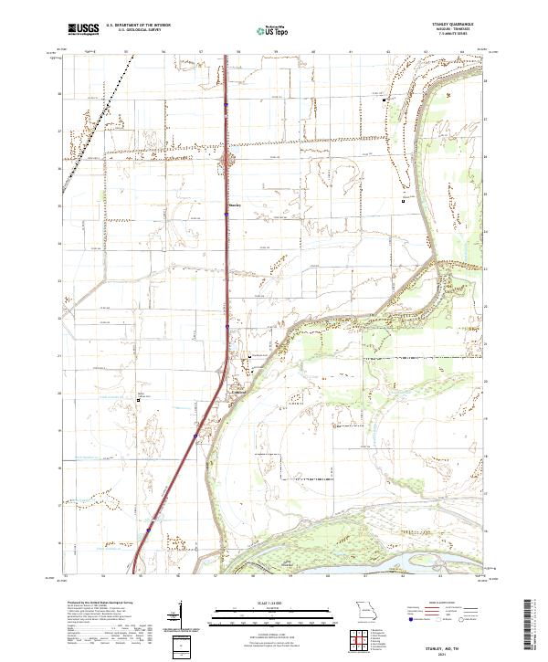
2021 Map of Stanley
USGS Topo · Published 2021About this map
The agricultural bottomlands of Pemiscot Co define this corner of the Missouri Bootheel, where the state line meets the Tennessee border along the Mississippi River. The landscape is heavily modified by a network of drainage infrastructure, including Ditch Number 23 and Ditch Number 22, which turned the former wetlands into productive fields. Small rural nodes like Stanley and Concord serve as anchor points along the highway corridors, while the area's history is preserved in scattered family and community burial grounds such as Stancil Cem, Ross Cem, and Mount Carmel Cem. Along the river's edge, shifting hydrology is evident at Sandy Hook-Bar and the winding reaches of Robinson Bayou, illustrating the constant negotiation between the river and the reclaimed farmland. The presence of Robinson Lake further highlights the remnant water bodies that characterize this delta-like environment.
Find a feature on this map
48 named features on this map. Tap any name to fly to it.
Don’t see what you’re looking for? This feature index may not catch every label — zoom into the map to look around manually.
Map Details
Editions of this 2021 Stanley Map
This is the sole edition of this map. No revisions or reprints were ever made.
Other maps of this area

1939 · Portageville
USGS Topo · 1:62,500

1939 · Caruthersville
USGS Topo · 1:62,500

1940 · Pascola
USGS Topo · 1:62,500

1940 · Hayti
USGS Topo · 1:62,500

1951 · Caruthersville
USGS Topo · 1:62,500

1955 · Pascola
USGS Topo · 1:62,500

1955 · Hayti
USGS Topo · 1:62,500

1955 · Portageville
USGS Topo · 1:62,500

1956 · Dyersburg
USGS Topo · 1:250,000

1957 · Caruthersville
USGS Topo · 1:62,500