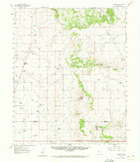
1960 Map of Stanley
USGS Topo · Published 1973About this map
The high plains and mesas of Central New Mexico are defined here by a network of ranching homesteads and drainage draws as they appeared in 1960. Stanley serves as the primary settlement anchor, with the nearby Stanley Cem providing a genealogical touchstone for local families. The landscape is marked by numerous family-named properties, including the Bill Kaniradt Ranch, Fronabarger Ranch, and Erramousbe Ranch, illustrating the vast pastoral landholdings of the era.
Find a feature on this map
55 named features on this map. Tap any name to fly to it.
Don’t see what you’re looking for? This feature index may not catch every label — zoom into the map to look around manually.
Map Details
Editions of this 1960 Stanley Map
3 editions found

Other maps of this area

1892 · San Pedro
USGS Topo · 1:125,000

1894 · Lamy
USGS Topo · 1:125,000

1917 · Estancia
USGS Topo · 1:125,000

1954 · Santa Fe
USGS Topo · 1:250,000

1954 · Fort Sumner
USGS Topo · 1:250,000

1954 · Socorro
USGS Topo · 1:250,000

1956 · Edgewood
USGS Topo · 1:62,500

1956 · Estancia
USGS Topo · 1:62,500

1958 · Socorro
USGS Topo · 1:250,000

1958 · Fort Sumner
USGS Topo · 1:250,000