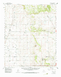
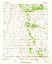
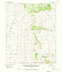
1960 Map of Stanley
USGS Topo · Published 1987About this map
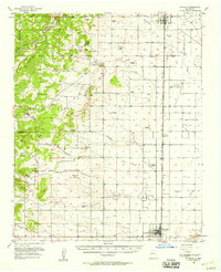
The settlement of Stanley and its surrounding ranchlands define this high-altitude landscape where the Santa Fe Co Torrance Co line bisects the territory. This area is characterized by an extensive network of family-held properties, including the Kamradt Ranch, Anaya Ranch, and Montaño Ranch, illustrating the deep-rooted agricultural heritage of the Estancia Valley region. Water management is a primary theme of the terrain, as seen in the drainage patterns of Armijo Draw and Kinsell Draw leading toward notable natural features like the White Lakes and Rock Lake.
Find a feature on this map
54 named features on this map. Tap any name to fly to it.
Don’t see what you’re looking for? This feature index may not catch every label — zoom into the map to look around manually.
Map Details
Editions of this 1960 Stanley Map
3 editions found
Other maps of this area

1892 · San Pedro
USGS Topo · 1:125,000

1894 · Lamy
USGS Topo · 1:125,000

1917 · Estancia
USGS Topo · 1:125,000

1954 · Santa Fe
USGS Topo · 1:250,000

1954 · Fort Sumner
USGS Topo · 1:250,000

1954 · Socorro
USGS Topo · 1:250,000
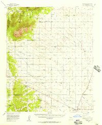
1956 · Edgewood
USGS Topo · 1:62,500
1956 · Estancia
USGS Topo · 1:62,500

1958 · Socorro
USGS Topo · 1:250,000

1958 · Fort Sumner
USGS Topo · 1:250,000