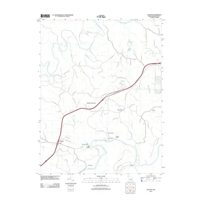
2012 Map of Stanton
USGS Topo · Published 2012About this map
The Bourbeuse River and Meramec River dominate this portion of Franklin County, framing a landscape shaped by water and transport. The central corridor is defined by the modern interstate path passing through Stanton and Anaconda, while the curious designation of Benson Tourist City sits just north of the highway, reflecting the area's mid-century identity as a travel destination. The southern reaches are anchored by Meramec State Park and a series of distinct valleys including Dutch Hollow, Hazel Hollow, and Iron Hollow. Local heritage is preserved in the locations of Kamper Cemetery and Brush Creek Cemetery. The transition from the riverbanks to the uplands is marked by smaller settlements like Twin Springs and Springs Hollow, alongside numerous named branches and creeks such as Happy Sock Creek and Payne Branch.
Find a feature on this map
85 named features on this map. Tap any name to fly to it.
Don’t see what you’re looking for? This feature index may not catch every label — zoom into the map to look around manually.
Map Details
Editions of this 2012 Stanton Map
This is the sole edition of this map. No revisions or reprints were ever made.
Other maps of this area

1901 · De Soto
USGS Topo · 1:125,000

1903 · Sullivan
USGS Topo · 1:125,000

1934 · Meramec State Park
USGS Topo · 1:24,000

1937 · Meramec State Park
USGS Topo · 1:24,000

1946 · Richwoods
USGS Topo · 1:62,500

1946 · Union
USGS Topo · 1:62,500

1947 · Sullivan
USGS Topo · 1:62,500

1947 · St. Clair
USGS Topo · 1:62,500

1948 · Richwoods
USGS Topo · 1:62,500

1948 · Union
USGS Topo · 1:62,500