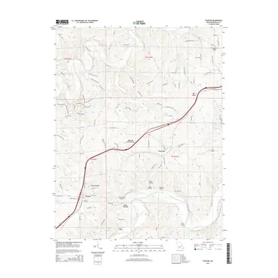
2015 Map of Stanton
USGS Topo · Published 2015About this map
The Meramec River winds through the southern portion of this Franklin County landscape, creating a distinct topographical divide characterized by numerous hollows like Iron Hollow and Twin Springs Hollow. This 2015 survey shows the development corridor along the interstate, connecting settlements such as Stanton, Anaconda, and the uniquely named Benson Tourist City. While the southern reaches remain defined by the river and its tributaries like Brush Cr, the northern section transitions toward the outskirts of St. Clair and the Bourbeuse River drainage.
Find a feature on this map
101 named features on this map. Tap any name to fly to it.
Don’t see what you’re looking for? This feature index may not catch every label — zoom into the map to look around manually.
Map Details
Editions of this 2015 Stanton Map
This is the sole edition of this map. No revisions or reprints were ever made.
Other maps of this area

1901 · De Soto
USGS Topo · 1:125,000

1903 · Sullivan
USGS Topo · 1:125,000

1934 · Meramec State Park
USGS Topo · 1:24,000

1937 · Meramec State Park
USGS Topo · 1:24,000

1946 · Richwoods
USGS Topo · 1:62,500

1946 · Union
USGS Topo · 1:62,500

1947 · Sullivan
USGS Topo · 1:62,500

1947 · St. Clair
USGS Topo · 1:62,500

1948 · Richwoods
USGS Topo · 1:62,500

1948 · Union
USGS Topo · 1:62,500