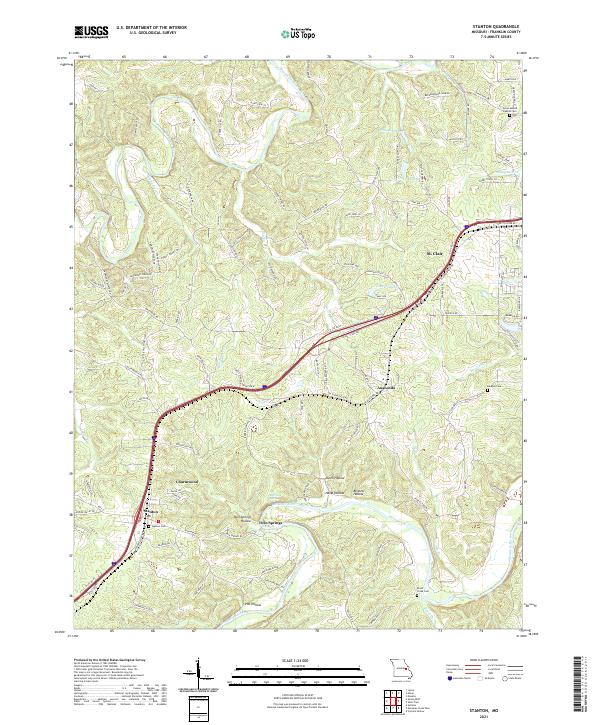
2021 Map of Stanton
USGS Topo · Published 2021About this map
The Meramec River and Bourbeuse River carve through this section of Franklin County, framing a landscape defined by ridges and hollows such as Sand Ford Ridge and Dutch Hollow. The modern transportation corridor of Interstate 44 bisects the region, connecting the larger community of St. Clair with smaller settlements like Anaconda, Charmwood, and Stanton. Near the river bends, the map reveals localized sites including Twin Springs and the Stanton PO. For family historians, several burial grounds are preserved across the terrain, notably the Green Mound Baptist Cem and Kamper Cem to the north, and Stanton Cem and Brush Creek Cem further south. The land use patterns reflect a mix of rural valley agriculture and modern residential development, visible in the network of local routes like State HWY Ab and Emily Cemetery RD.
Find a feature on this map
148 named features on this map. Tap any name to fly to it.
Don’t see what you’re looking for? This feature index may not catch every label — zoom into the map to look around manually.
Map Details
Editions of this 2021 Stanton Map
This is the sole edition of this map. No revisions or reprints were ever made.
Other maps of this area

1901 · De Soto
USGS Topo · 1:125,000

1903 · Sullivan
USGS Topo · 1:125,000

1934 · Meramec State Park
USGS Topo · 1:24,000

1937 · Meramec State Park
USGS Topo · 1:24,000

1946 · Richwoods
USGS Topo · 1:62,500

1946 · Union
USGS Topo · 1:62,500

1947 · Sullivan
USGS Topo · 1:62,500

1947 · St. Clair
USGS Topo · 1:62,500

1948 · Richwoods
USGS Topo · 1:62,500

1948 · Union
USGS Topo · 1:62,500