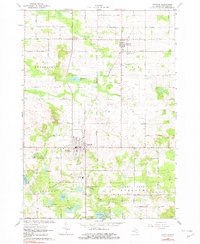
1964 Map of Stanton
USGS Topo · Published 1982About this map
Stanton serves as the focal point of this mid-1960s Montcalm County survey, showing a well-established grid of streets and institutional landmarks such as the Central High Sch and Forest Hill Cemetery. The Chesapeake and Ohio railroad cuts diagonally through the townships of Douglass, Day, and Sidney, connecting the city to McBrides and passing by numerous agricultural gravel pits.
Find a feature on this map
47 named features on this map. Tap any name to fly to it.
Don’t see what you’re looking for? This feature index may not catch every label — zoom into the map to look around manually.
Map Details
Editions of this 1964 Stanton Map
4 editions found
Other maps of this area

1954 · Midland
USGS Topo · 1:250,000

1958 · Midland
USGS Topo · 1:250,000

1959 · Midland
USGS Topo · 1:250,000

1964 · Edmore
USGS Topo · 1:24,000

1964 · Six Lakes
USGS Topo · 1:24,000

1964 · Langston
USGS Topo · 1:24,000

1964 · Stanton
USGS Topo · 1:24,000

1965 · Vestaburg
USGS Topo · 1:24,000

1965 · Crystal
USGS Topo · 1:24,000

1966 · Midland
USGS Topo · 1:250,000