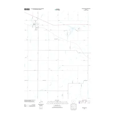
2013 Map of Stanton
USGS Topo · Published 2013About this map
Stanton serves as the primary hub of this Montgomery County landscape, with its residential grid defined by streets like Frankfort St and Thorn St. The surrounding countryside is defined by the branching waters of the Tarkio River and its various tributaries, including Little Tarkio Cr and E Tarkio Cr. A significant natural landmark, Viking Lake, provides a large body of water in the northeastern portion of the quadrangle, while Erickson Prairie offers a look at the preserved open lands of the region. The map also captures the transition at the southern boundary along Montgomery-Page St, where the topography leads toward the W Nodaway River valley. This 2013 survey illustrates the modern layout of rural Iowa, where a system of lettered avenues like O Ave and S Ave intersect with numbered section roads to form a precise agricultural and residential framework.
Find a feature on this map
51 named features on this map. Tap any name to fly to it.
Don’t see what you’re looking for? This feature index may not catch every label — zoom into the map to look around manually.
Map Details
Editions of this 2013 Stanton Map
This is the sole edition of this map. No revisions or reprints were ever made.
Other maps of this area

1954 · Omaha
USGS Topo · 1:250,000

1955 · Nebraska City
USGS Topo · 1:250,000

1957 · Nebraska City
USGS Topo · 1:250,000

1957 · Omaha
USGS Topo · 1:250,000

1958 · Omaha
USGS Topo · 1:250,000

1958 · Nebraska City
USGS Topo · 1:250,000

1978 · Stanton
USGS Topo · 1:24,000

1978 · Stanton SW
USGS Topo · 1:24,000

1978 · Wallin
USGS Topo · 1:24,000

1978 · Clarinda North
USGS Topo · 1:24,000