
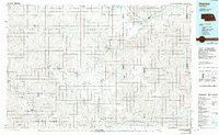
1985 Map of Stanton
USGS Topo · Published 1985About this map
The Elkhorn River valley and its surrounding plains are the focal point of this 1980s-era study, documenting a landscape shaped by water and iron. The Chicago and North Western line follows the river corridor through Stanton, while the Union Pacific cuts through Madison to the south. A notable historical alignment, the Old Indian Treaty Boundary, runs diagonally across the grid, intersecting the Old Railroad Grade near Newman Grove.
Find a feature on this map
91 named features on this map. Tap any name to fly to it.
Don’t see what you’re looking for? This feature index may not catch every label — zoom into the map to look around manually.
Map Details
Editions of this 1985 Stanton Map
2 editions found
Other maps of this area

1896 · Stromsburg
USGS Topo · 1:125,000

1899 · Wahoo
USGS Topo · 1:125,000

1899 · David City
USGS Topo · 1:125,000

1899 · St. Paul
USGS Topo · 1:125,000

1954 · Albion West
USGS Topo · 1:24,000

1954 · Belgrade
USGS Topo · 1:24,000

1954 · Cedar Rapids SE
USGS Topo · 1:24,000

1955 · Broken Bow
USGS Topo · 1:250,000

1955 · Sioux City
USGS Topo · 1:250,000

1955 · Fremont
USGS Topo · 1:250,000