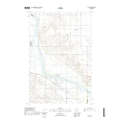
2018 Map of Stanton SE
USGS Topo · Published 2018About this map
Knife River Indian Villages National Historic Site borders the western edge of this landscape, marking a site of deep historical significance along the Missouri River. The terrain transitions from the river's wide alluvial plain to the dissected uplands of McLean County, characterized by a complex network of coulees and ridges. Local history is anchored by rural landmarks such as Basto Cem, Alderin Cem, and Deapolis Cem, which serve as quiet markers of early settlement patterns in the region. Transportation follows a mix of established section-line roads like Co Hwy 20 and more organic routes such as The Cow Trl. The confluence of Alderin Cr and the Missouri River illustrates the hydraulic nature of the land, which has long dictated the placement of homesteads and cemetery sites away from the seasonal floodplains.
Find a feature on this map
30 named features on this map. Tap any name to fly to it.
Don’t see what you’re looking for? This feature index may not catch every label — zoom into the map to look around manually.
Map Details
Editions of this 2018 Stanton SE Map
This is the sole edition of this map. No revisions or reprints were ever made.
Other maps of this area

1948 · Stanton
USGS Topo · 1:62,500

1949 · Stanton
USGS Topo · 1:62,500

1949 · Washburn
USGS Topo · 1:62,500

1954 · McClusky
USGS Topo · 1:250,000

1958 · McClusky
USGS Topo · 1:250,000

1961 · Underwood
USGS Topo · 1:24,000

1967 · Washburn SW
USGS Topo · 1:24,000

1967 · Stanton SE
USGS Topo · 1:24,000

1968 · Hannover NE
USGS Topo · 1:24,000

1968 · Fort Clark
USGS Topo · 1:24,000