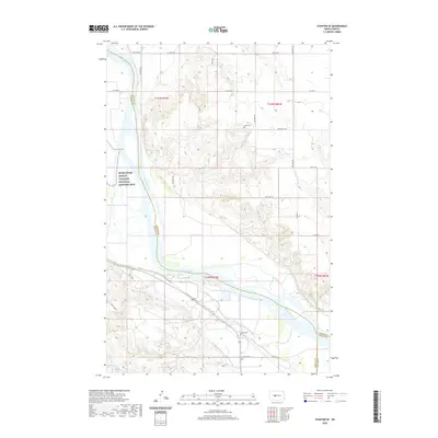
2020 Map of Stanton SE
USGS Topo · Published 2020About this map
The Missouri River carves a deep valley through this portion of McLean, Mercer, and Oliver counties, defining a landscape where indigenous history and pioneer-era settlement meet. On the western bank, the Knife River Indian Villages National Historic Site preserves a critical cultural landscape near the river's confluence with its namesake tributary. The surrounding uplands are marked by the presence of early community landmarks, including Basto Cem, Alderin Cem, and Deapolis Cem, which serve as primary points of interest for genealogists tracing families in these prairie townships. Local transport is facilitated by a network of county roads like Co Hwy 20 and rustic routes such as The Cow Trl, while Alderin Cr feeds into the main river channel from the south.
Find a feature on this map
29 named features on this map. Tap any name to fly to it.
Don’t see what you’re looking for? This feature index may not catch every label — zoom into the map to look around manually.
Map Details
Editions of this 2020 Stanton SE Map
This is the sole edition of this map. No revisions or reprints were ever made.
Other maps of this area

1948 · Stanton
USGS Topo · 1:62,500

1949 · Stanton
USGS Topo · 1:62,500

1949 · Washburn
USGS Topo · 1:62,500

1954 · McClusky
USGS Topo · 1:250,000

1958 · McClusky
USGS Topo · 1:250,000

1961 · Underwood
USGS Topo · 1:24,000

1967 · Washburn SW
USGS Topo · 1:24,000

1967 · Stanton SE
USGS Topo · 1:24,000

1968 · Hannover NE
USGS Topo · 1:24,000

1968 · Fort Clark
USGS Topo · 1:24,000