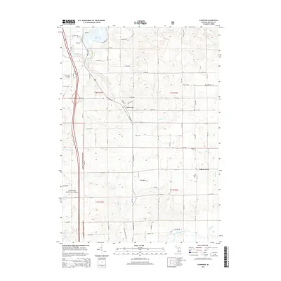
2014 Map of Stanwood
USGS Topo · Published 2014About this map
The Muskegon River and its expansive Rogers Dam Pond anchor the western edge of this Mecosta County landscape, where the village of Stanwood sits at the junction of Northland Drive and 8 Mile Road. The area is defined by a transition from the wooded corridors of the Manistee National Forest to a systematic grid of agricultural sections. The modern rails-to-trails conversion of the White Pine Trail State Park traces the historic path of the railroad through the heart of the township, connecting the primary settlements. To the south and east, small rural hubs like Borland and Higbee Corner illustrate the distribution of early 21st-century Michigan communities. Genealogists will find significant value in the distribution of family-named landmarks and burial sites, including Ladner Cemetery, Holt Cemetery, and the isolated Higbee Cemetery near the headwaters of Quigley Creek.
Find a feature on this map
47 named features on this map. Tap any name to fly to it.
Don’t see what you’re looking for? This feature index may not catch every label — zoom into the map to look around manually.
Map Details
Editions of this 2014 Stanwood Map
This is the sole edition of this map. No revisions or reprints were ever made.
Other maps of this area

1954 · Midland
USGS Topo · 1:250,000

1958 · Midland
USGS Topo · 1:250,000

1958 · Sand Lake
USGS Topo · 1:62,500

1958 · Woodville
USGS Topo · 1:62,500

1958 · Big Rapids
USGS Topo · 1:62,500

1959 · Midland
USGS Topo · 1:250,000

1959 · Howard City
USGS Topo · 1:62,500

1966 · Midland
USGS Topo · 1:250,000

1976 · Big Rapids SE
USGS Topo · 1:24,000

1976 · Big Rapids SW
USGS Topo · 1:24,000