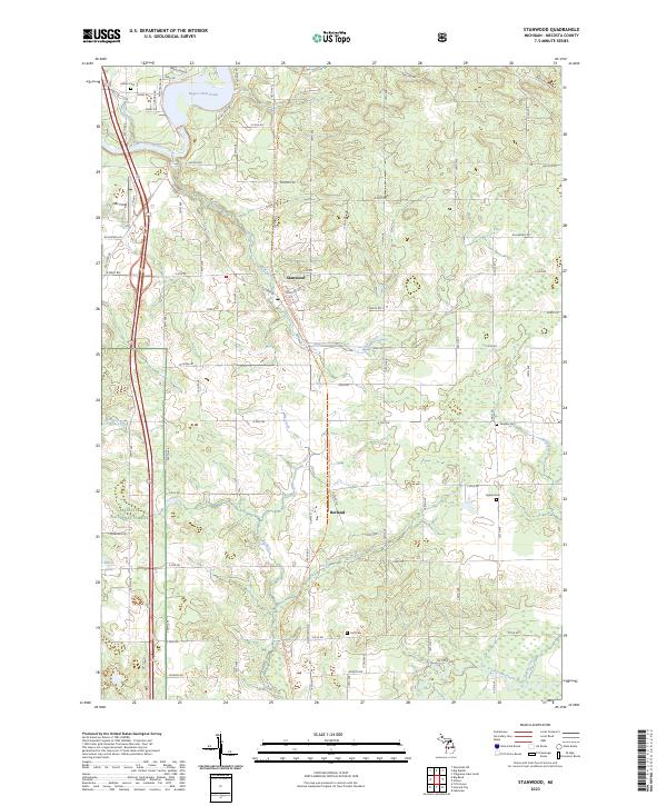
2023 Map of Stanwood
USGS Topo · Published 2023About this map
The village of Stanwood and the community of Borland anchor this part of Mecosta County, where the north-south corridor of Northland Dr intersects a grid of numbered roads. To the northwest, the Muskegon River flows into the Rogers Dam Pond, a significant hydraulic feature that dominates the upper corner of the map. This landscape is defined by the transition from the structured farm and residential plots of the eastern townships into the protected timberlands of the Manistee National Forest along the western edge. Family history and local heritage are preserved in several scattered burial grounds, including Ladner Cem near the river and Higbee Cem to the southeast. The drainage of the land is marked by numerous small waterways like Meeks Creek, Big Creek, and the Little Muskegon River, which wind through the forested and agricultural terrain.
Find a feature on this map
51 named features on this map. Tap any name to fly to it.
Don’t see what you’re looking for? This feature index may not catch every label — zoom into the map to look around manually.
Map Details
Editions of this 2023 Stanwood Map
This is the sole edition of this map. No revisions or reprints were ever made.
Other maps of this area

1954 · Midland
USGS Topo · 1:250,000

1958 · Midland
USGS Topo · 1:250,000

1958 · Sand Lake
USGS Topo · 1:62,500

1958 · Woodville
USGS Topo · 1:62,500

1958 · Big Rapids
USGS Topo · 1:62,500

1959 · Midland
USGS Topo · 1:250,000

1959 · Howard City
USGS Topo · 1:62,500

1966 · Midland
USGS Topo · 1:250,000

1976 · Big Rapids SE
USGS Topo · 1:24,000

1976 · Big Rapids SW
USGS Topo · 1:24,000