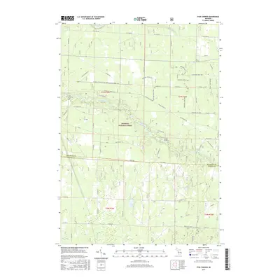
2017 Map of Star Corners
USGS Topo · Published 2017About this map
The Little Manistee River meanders through the central corridor of this survey, defining a landscape dominated by the protected acreage of the Manistee National Forest. This region at the boundary of Manistee and Mason counties remains largely undeveloped, characterized by a complex network of forest roads and the Marzinski Horse Trail. Near the western edge, the Old Stronach Cemetery serves as a significant genealogical marker for the township, located just south of the river valley. The map documents several water bodies including Claybank Bayou in the north and Hoags Lake further south. The settlement of Star Corners sits at a crossroads in the northeast, while the Sixmile Bridge provides a key crossing point for Six Mile Bridge Road as it spans the river. The concentration of wetlands and small tributaries like Claybank Creek reflects the drainage patterns that have shaped local land use and conservation efforts.
Find a feature on this map
32 named features on this map. Tap any name to fly to it.
Don’t see what you’re looking for? This feature index may not catch every label — zoom into the map to look around manually.
Map Details
Editions of this 2017 Star Corners Map
This is the sole edition of this map. No revisions or reprints were ever made.
Other maps of this area

1931 · Manistee SE
USGS Topo · 1:31,680

1931 · Freesoil SW
USGS Topo · 1:31,680

1932 · Freesoil SE
USGS Topo · 1:31,680

1954 · Manitowoc
USGS Topo · 1:250,000

1956 · Onekama
USGS Topo · 1:62,500

1956 · Bar Lake
USGS Topo · 1:62,500

1957 · Freesoil
USGS Topo · 1:62,500

1958 · Manitowoc
USGS Topo · 1:250,000

1958 · Manistee
USGS Topo · 1:62,500

1976 · Onekama SE
USGS Topo · 1:24,000